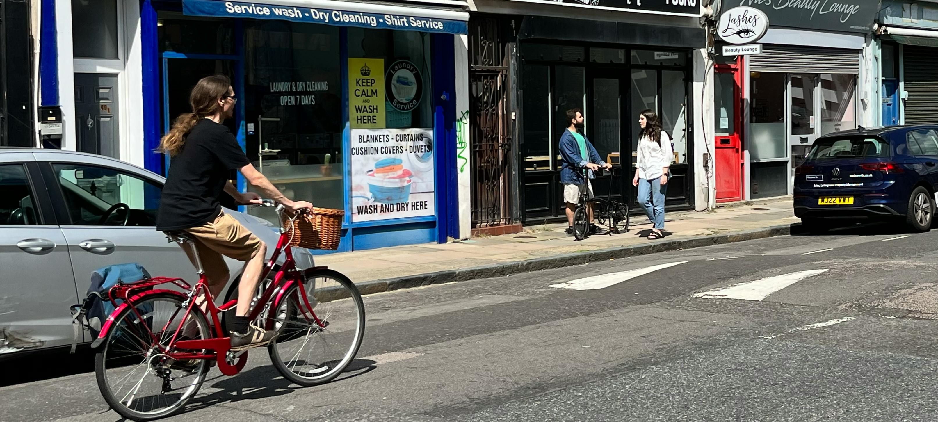
Mildmay Liveable Neighbourhood
We are creating a liveable neighbourhood in Mildmay
Islington Council is determined to create greener, healthier, and more welcoming streets, where people can come together and communities can thrive.
The council announced the Mildmay Liveable Neighbourhood project in February 2020 as Islington's first liveable neighbourhood project, including £1m of council capital funding to deliver the project.
We developed proposals for the project through engagement with residents and businesses between 2021 and 2023 to hear what local people wanted to see improved in the Mildmay area. In autumn 2023 we held a public consultation on our final draft proposals.
We started constructing the scheme in autumn 2024 and expect construction of the main elements of the project to be complete by end of 2026.
We'll notify affected residents and businesses ahead of construction, and will work to keep any disruption to a minimum. We will keep local people updated as the scheme progresses. You can also check this page for updates.
Latest project updates
We started constructing the first elements of the project in November 2024.
King Henry's Walk transformation construction from Spring to Autumn 2026
The transformative improvements planned on King Henry's Walk between Mildmay Road and the railway bridge will begin construction from Monday 23 March 2026. These improvements will be the last large construction project within in the Mildmay Liveable Neighbourhood.
These improvements will also stretch a few metres into Queen Margaret’s Grove, St Jude Street, Mildmay Road, and Mildmay Grove North.
These improvements comprise:
- widening pavements on both sides of King Henry's Walk between Mildmay Grove North and Mildmay Road
- installing new seating, trees and roadside planting
- improving crossings for people walking and wheeling
- installing new cycle parking
- introducing a new dedicated loading bay for businesses
- narrowing the road to slow down vehicles and to prioritise people walking and spending time in the area
As part of this scheme, Queen Margaret’s Grove will also be permanently closed to motor traffic at the junction with King Henry’s Walk, and a new public space will be constructed in what is currently the road junction. The public space will contain new seating, new trees and planting beds, and a large plaza space.
To carry out these improvements, some parking spaces will be permanently removed on King Henry’s Walk, St Jude Street, Queen Margaret’s Grove, Mildmay Road, and Mildmay Grove North.
You can view a design drawing showing the new King Henry's Walk road layout here.
The Queen Margaret's Grove public space design will be among the last elements of the scheme to be constructed. You can view a design drawing showing the new Queen Margaret's Grove public space here.
To carry out these works, it is expected that sections of King Henry’s Walk, Queen Margaret’s Grove, St Jude Street, Mildmay Grove North, and Mildmay Road will have parking spaces suspended at certain times within the overall 16-week construction period. Please see notices posted on street for the latest information relating to parking suspensions. The map image below shows the sections of car parking which will be impacted.
A range of temporary road closures and diversions will also be in effect at different points during the overall 16-week construction period. Vehicle access will be maintained to all addresses during any road closures, however some vehicle journeys will need to follow diversions during these times.
Please note that during any temporary road closures or diversions, some nearby traffic restrictions in the wider area (for example, the traffic filters on St Jude Street and Mildmay Road) may be temporarily suspended in order to maintain vehicle access to adjacent addresses, where relevant.
Please note that at present, the School Street scheme covering Mildmay Road west of Woodville Road and Wolsey Road north of Queen Margaret's Grove is currently not operational, in order to facilitate the construction works at King Henry's Walk.
 Map image showing the King Henry's Walk transformation scheme impacted area, and the parking spaces which will be permanently removed, or temporarily suspended, as part of the scheme
Traffic filters
 "No Motor Vehicles" road sign, which is clearly displayed at the traffic filter points
 Example "No Motor Vehicles" road sign displayed on a planter box in the street, marking the location of an existing traffic filter on Cross Street
The council will closely monitor the impact of the new traffic filters after they are installed, as well as monitoring the impacts of the overall Mildmay Liveable Neighbourhood scheme more broadly.
Exemptions to the traffic filters
Most people are not entitled to an exemption to drive through the traffic filters. Residents in the area (including people holding an Estate car parking permit or an on-street parking permit) do not automatically get an exemption to the traffic filters.
This approach matches the other schemes already in place around other parts of the borough which have been implemented over the last few years, such as in parts of Canonbury, Highbury, St Peters, and Amwell. You can see a full map of these restrictions around the borough.
The "IBBH" exemption permit, which has been in place since 13th February 2026, allows people to drive through these traffic filters. If you live in Islington and hold a Blue Badge or Free Resident's Permit, you are eligible to get the "IBBH" exemption permit.
We also have an Individual Exemptions policy which gives exemptions to all Islington traffic filters to people whose health and wellbeing would be severely impacted by traffic filters.
You can find out more about our Blue Badge holders exemptions policy(External link) and Individual exemptions policy(External link) on our website.
Accessing the area by motor vehicle
The map below shows how to access different parts of the project area by motor vehicle, starting from Monday 27 October 2025, when the first three traffic filters came into effect. These traffic filters are located at the east end of Mildmay Road, at the east end of St Jude Street, and on King Henry’s Walk adjacent to the Adventure Playground.
 Map showing how to access different parts of the project area by motor vehicle after the traffic filters have been constructed, from Monday 27 October 2025
Addresses on the following roads can be accessed by motor vehicle via Mildmay Park only. These roads fall within “sub-area A” in the map above:
- Mildmay Grove South
- Mildmay Grove North
- Wolsey Road
- Queen Margaret’s Grove
- King Henry’s Walk (north of the King Henry’s Walk Adventure Playground)
- St Jude Street
- Kingsbury Road north of the railway bridge
- Mildmay Road (west of the existing width restriction, close to the junction with Boleyn Road)
- Woodville Road, Elton Place, and King Henry Street
Addresses on the following roads can be accessed via Balls Pond Road only. These roads fall within “sub-area B” in the map above:
- King Henry’s Walk (south of the King Henry’s Walk Adventure Playground)
- Kingsbury Road south of the railway bridge (no change from the current situation)
Numbers 1, 3 and 5 Mildmay Road are accessed by motor vehicle via Crossway from the A10, or alternatively from Newington Green via Matthias Road and Boleyn Road. Similarly, access by vehicle to all addresses on Matthias Road, Boleyn Road, Pellerin Road, Crossway and John Campbell Road, Gillett Street / Gillet Square, Bradbury Street, Kingsland Green and Kingsland Passage is via Crossway from the A10 or alternatively from Newington Green via Matthias Road and Boleyn Road.
You can find out more about traffic filters by looking at our Frequently Asked Questions.
School Street timed restriction on Mildmay Road and Wolsey Road [CURRENTLY SUSPENDED)
Please note that the School Street scheme is currently not operational. This is because of temporary construction works taking place on King Henry's Walk, adjacent to the school street zone.
The council installed a new School Street scheme on Mildmay Road between Newington Green and Woodville Road, and on Wolsey Road between Mildmay Road and Queen Margaret's Grove, on Monday 15 September 2025.
The School Street scheme is a timed pedestrian and cycle zone. The zone is in operation from 8.15-9.15am and 3.00-3.45pm on weekdays during school term time. If you drive into this zone without an exemption permit during these times, you may receive a fine.
Please note that if your vehicle is already parked in this zone, then you are allowed to drive out of the zone during the operational hours without incurring a fine. You only risk receiving a fine when driving into the zone during operational hours.
If your main place of residence, employment, business or organization are located within the following addresses, you are eligible for an "SS44" exemption permit to the School Street scheme:
- Auriga Mews
- Mayville Estate: Bronte House, Emerson House, Gay House, Lydgate House, Sewell House, Skelton House and Waller House
- Mildmay Park (Nos. 80–92)
- Mildmay Road (Nos. 95–146)
- Newington Green (Nos. 15–19)
- Wolsey Road (Nos. 1–12 and 30–35)
The "SS44" exemption permit allows you to drive within this zone at all times without receiving a fine.
Please visit this webpage for more details about how to apply for the school street exemption permit: https://www.islington.gov.uk/roads/people-friendly-streets/school-streets/school-street-exemptions.
 School Street scheme extents on Mildmay Road between Newington Green and Woodville Road, and on Wolsey Road between Queen Margaret's Grove and Mildmay Road. If you drive in this area between 8.15-9.15am and 3.00-3.45pm on a weekday during school term time you may receive a fine.
 Overall project progress
The table below shows the construction progress of different project elements and is updated by the project team as the construction of each element progresses.
You can view the design drawings for the schemes that have been completed, and those currently under construction, using the links in the “What are the final plans we will be implementing?” section on this page, or in the Key Documents menu.
| Project element | Construction progress |
| Improved accessible pavements around the Mildmay area | Completed in December 2024 |
| Improved more accessible path within the Mayville Estate between Waller, Skelton and Bronte houses | Completed in January 2025 |
| Greening on Arundel Grove | Completed in March 2025 |
| Loading bay on Mildmay Grove North adjacent to Mildmay Park | Completed in April 2025 |
| Walking, wheeling and cycling improvements around Newington Green | Completed in July 2025 |
| Improved public space on Ferntower Road at Newington Green | Completed in July 2025 |
| Child-friendly street outside Newington Green Primary School | Completed in July 2025 |
| School Street zone outside Newington Green Primary School | Completed in September 2025 |
| Traffic filters on King Henry's Walk, St Jude Street, and Mildmay Road | Completed in October 2025 |
| Walking, wheeling and cycling improvements on Boleyn Road | Completed in January 2026 |
| King Henry's Walk transformation | Under construction from March 2026 |
| Greener child friendly St Jude Street | Construction expected to begin in 2026 |
| One-way traffic filter on Boleyn Road / Matthias Road | Construction expected to begin in 2026 |
| Reversal of one-way section at the far southern end of Boleyn Road between the A10 and Kingsland Passage | Construction expected to begin in 2026 |
What are the final plans we will be implementing?
 Map of the Mildmay Liveable Neighbourhood project final measures we will be implementing
These measures are:
1. Transforming King Henry's Walk to create a welcoming space at the heart of the community and help local businesses to thrive, by:
- widening pavements between Mildmay Grove North and Mildmay Road
- installing new seating and greenery on pavements
- creating a new public space at the end of Queen Margaret's Grove
- improving crossings for people walking and wheeling
- introducing a new dedicated loading bay for businesses
- creating a greener connection between King Henry's Walk and St Jude Street Garden
2. Creating a child-friendly street outside Newington Green Primary School (NGPS), by:
- relocating the school's main entrance to Auriga Mews, in partnership with NGPS, and improvements to Auriga Mews to provide an attractive entrance with more space for people walking and wheeling
- making the pavements wider and greener with fun features for children, to create a pleasant space for people waiting at school pick-up time
- introducing a trial School Street zone on Mildmay Road, Wolsey Road and Auriga Mews around the new school entrance. No motor traffic will be permitted to enter during school drop-off and pick-up hours, except residents who live in the zone. We will monitor the trial School Street to help assess whether it should be made permanent.
You can view the final design drawing for this scheme.
3. Creating a greener, child-friendly street on St Jude Street to make the street safe and inviting for people travelling to local schools and those visiting St Jude Street Garden which is being improved. We will be creating new greenery alongside the park, and the measures will also make it safer for people cycling on Cycleway 1.
4. Introducing new traffic filters as a trial at the locations shown on the map. The scheme aims to reduce air pollution and road danger by preventing through-traffic from cutting through the area. Traffic filters are points in the road that vehicles are not permitted to drive through, to make space for walking, cycling, and wheeling. In some cases these are enforced with physical restrictions like planters and bollards, and in others using cameras. There will be exemptions for local Blue Badge holders who live inside the project area, some council service vehicles, and the emergency services. We will monitor the trial traffic filters to assess whether they should be made permanent.
The first batch of traffic filtering measures as part of the Mildmay Liveable Neighbourhood project were introduced from Monday 27 October 2025. These traffic filters are located at the east end of Mildmay Road, at the east end of St Jude Street, and on King Henry’s Walk adjacent to the Adventure Playground. You can see more details about this first phase of traffic filtering here.
A fourth planned northbound-only bus gate on Boleyn Road / Matthias Road, and the linked reversal of direction to the short one-way section of Boleyn Road (at its very southern end where it meets the A10) are both planned to be implemented at a later date. Islington Council continue to work closely with Hackney Council and Transport for London to progress these schemes, which together form a further part of the overall Mildmay Liveable Neighbourhood project announced in autumn 2024.
5. Making improvements for walking, wheeling and cycling around Newington Green, including:
- safer crossings - raising up zebra crossings to pavement level and improving visibility
- a traffic-free cycleway along the south side of the Green as part of an important link between Cycleway 1 and Green Lanes
- A new designated loading bay to help businesses around the Green
- new green planting on pavements
You can view the final design drawings for the scheme:
- Newington Green walking, wheeling and cycling improvements between Mildmay Road and Ferntower Road
- Newington Green zebra crossing improvements to the west and north east of the Green
6. An improved public space where Ferntower Road meets Newington Green, including:
- creating more community space by extending the paved area further west into Ferntower Road
- re-spacing the planters, with additional seating, retaining the greenery
- amending the layout to enable safe cycle access along the south side of the space, in response to your consultation feedback on this proposal
You can view the final design drawing for this scheme.
7. Walking, wheeling and cycling improvements on Boleyn Road, including:
- improving Cycleway 1 by creating a traffic-free cycle lane with raised kerbs to protect people cycling from traffic, and an improved crossing between Boleyn Road and Wordsworth Road
- a new zebra crossing to make it easier and safer for people walking and wheeling to cross the road between housing areas to help enable safer journeys between Mildmay and Kingsland High Street
You can view the final design drawing for this scheme.
8. Improved and more accessible pavements and paths to help people walk and wheel in the Mayville Estate and around the area. In 2024 we completed refreshed paving and improved dropped kerbs at a number of locations in the project area. You can see a summary of our 2024 pavement accessibility improvements for more details.

9. A new loading bay on Mildmay Grove North by the junction with Mildmay Park to improve loading for the grocery shop there
You can view the final design drawing for this scheme.
10. New greenery on Arundel Grove, opposite number 54 Arundel Grove near to King Henry Street, including a new bench for people to sit and rest.
You can view the final design drawing for this scheme.
Project background
The council announced the Mildmay Liveable Neighbourhood project in February 2020 as Islington's first liveable neighbourhood project, including £1m of council capital funding to deliver the project.
The project involves a number of changes to streets, aimed at improving air quality and making the area greener, safer and easier for people to walk, cycle and use buggies and wheelchairs.
The project is focused on the east area of the Mildmay ward, between Newington Green and Dalston. In the future, we expect a separate liveable neighbourhood project will focus on the area west of Newington Green and Green Lanes.
What you have told us through the project
Since the project was announced in February 2020, the council has been listening to feedback from residents in the Mildmay area.
In 2021 and 2022 we heard what local people had to say about issues in the area and what they would like the project to bring to the area, through public meetings, workshops and engagement with schoolchildren.
Between February and April 2023 we invited the community to share their views on draft proposals through a survey and public workshops. We also met with local businesses and schools, local older and disabled people and members of the Turkish-speaking community, and held activities with young people. You can see a summary of the engagement and responses.
In September and October 2023 we consulted publicly on a set of final draft proposals which were displayed both online and at Mildmay Library. Again, we received feedback through a survey, public workshops and talking to local businesses.
We have also received comments sent via email to the project team at: mildmay.liveableneighbourhood@islington.gov.uk.
Our consultation proposals reflected what local people told us they wanted to see improved in the Mildmay area:
- safer crossings on Newington Green and other main and borough-boundary roads in the area
- more accessible routes for mobility-impaired people, including in the Mayville Estate
- improved air quality, and less traffic on local streets
- greener streets with more trees and planting
- more places to stop, rest and socialise in local streets
- more child-friendly streets around schools in the area
- safer and more joined up cycle routes in the area, including improving Cycleway 1 and linking it to Green Lanes
Your feedback to our consultation in autumn 2023
Most people who responded to our consultation survey in September-October 2023 said they agreed that the Mildmay Liveable Neighbourhood would be positive for the area and people's health and wellbeing in response to a range of statements. Some examples of these statements and your responses are:
| "The proposed scheme would..." | Strongly agree | Agree | Neither | Disagree | Strongly disagree |
| Make it safer for children to travel to school and/or play outdoors | 52% | 11% | 9% | 6% | 18% |
| Make the streets safer for people walking, wheeling and cycling | 51% | 12% | 6% | 7% | 23% |
| Help make the air in the area cleaner | 50% | 11% | 10% | 5% | 20% |
| Create a street environment that will help people have good mental health and wellbeing | 48% | 12% | 10% | 5% | 22% |
| Make me more likely to walk or cycle to local shops and businesses | 47% | 10% | 13% | 6% | 24% |
The most common comments we received in support of our consultation proposals were:
- overall support for the scheme
- support due to improved safety for people cycling
- support for walking and wheeling improvements
The most common comments we received expressing concerns about our consultation proposals were:
- Ferntower Road cycle access would negatively impact the existing public seating area
- traffic fIltering may increase congestion on nearby roads
- potential negative impact on people with limited mobility
You can see:
- the proposals we consulted on in autumn 2023
- a report showing the consultation results in detail
- responses to issues raised in the consultation
What changes are we making in response to your consultation feedback?
In response to your feedback we will be:
- amending the planned layout of the planting and seating area at Ferntower Road/Newington Green to: position the cycle path along the southern edge of the space rather than through the centre, using accessible materials and tactile crossings that are sympathetic to the existing space; and re-provide and improve the public seating and greenery with additional seats on the planters
- introducing a 'Copenhagen crossing' (continuous pavement across the road at the crossing point) at the junction of Mildmay Road and Newington Green to prioritise people walking and wheeling
- making the planned public space at the junction of King Henry's Walk and Queen Margaret's Grove larger, with new trees and planting
- extending the length of the planned loading bay on King Henry's Walk to make sure it supports businesses
- creating a larger public space area at the junction of Mildmay Road and Wolsey Road outside the planned new entrance to Newington Green Primary School, with features such as boulders that children can play on separated from the road by planting, and creating a nicer paved surface on Auriga Mews to provide an attractive school entrance with more space for people walking and wheeling
- providing space for ambulances to drive through the traffic filter on St Jude Street
- increasing the number of locations where we will improve pavements to make them more accessible.
In our consultation, we asked your views on proposals to improve the area outside Conrad House in the Mayville Estate for walking, wheeling and cycling, including new paved space and greenery, a cycle path and relocated bin stores. We have been talking to estate residents further to understand more about what they would like to see in this space, and will continue talking to residents to finalise the scheme.
How you can get in touch
If you have any questions about the project, or you need this information in another language, a reading format such as Braille, large print or Easy Read, or a printed paper copy of these webpages, you can:
- email: mildmay.liveableneighbourhood@islington.gov.uk
- write to: Environment, 1 Cottage Road, London, N7 8TP
We will keep local people updated as the scheme progresses. You can also check this page for updates.
Key documents
-
 Final scheme design drawings
-
 Design drawing: Newington Green walking, wheeling and cycling improvements between Mildmay Road and Ferntower Road.pdf (3.38 MB) (pdf)
-
Design drawing: Newington Green improvements to west and north east zebra crossings.pdf (587 KB) (pdf)
-
Design drawing: Ferntower Road public space design (1.89 MB) (pdf)
-
Design drawing: Arundel Grove greening.pdf (1.99 MB) (pdf)
-
Design drawing: Mayville Estate path walking and wheeling improvements between Mildmay Road and Matthias Road.pdf (612 KB) (pdf)
-
Design drawing: Mildmay Grove North loading bay.pdf (450 KB) (pdf)
-
Design drawing Mildmay Road-Wolsey Road-Auriga Mews child-friendly improvements.pdf (2.56 MB) (pdf)
-
Design drawing Boleyn Road walking and cycling improvements.pdf (2.6 MB) (pdf)
-
Design drawing King Henrys Walk transformation main works.pdf (2.77 MB) (pdf)
-
Design drawing Queen Margarets Grove public space.pdf (3.55 MB) (pdf)
-
-
Consultation documents
-
Artist's impression of our planned improvements at Mildmay Road/Wolsey Road outside Newington Green Primary School (2.26 MB) (jpg)
-
Pavement accessibility improvements constructed in the area up to August 2024 (5.09 MB) (pdf)
-
Traffic filters October 2025 notification letter (629 KB) (pdf)


